himach
![]()
The goal of himach (“high Mach”) is to support modelling
and analysis of the market for supersonic aircraft by generating good
routes for aircraft which can fly supersonic over the ocean, but only
subsonic over land.
In this version of himach, ‘good’ usually means the
fastest, so the key indicator is time advantage over flying in a
subsonic aircraft.
It is not an operational tool. Please don’t fly these routes, which do not allow for wind or other atmospheric conditions, and are based on a very simple model of aircraft performance.
You can install the latest CRAN release using:
install.packages("himach")You can install the current development version of
himach from github with:
install.packages("devtools")
devtools::install_github("david6marsh/himach")
For the vignette and testing, this package uses a map of New Zealand
map based on Stats NZ’s data which are licensed by Stats NZ for re-use
under the Creative Commons Attribution 4.0 International licence. Map
shown above uses data from www.naturalearthdata.com, from through the
rnaturalearthdata, and rnaturalearthhires
packages.
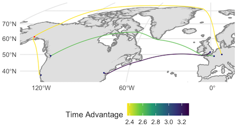
himach?A second generation of supersonic passenger aircraft is under development (taking Concorde to be the first generation). These will normally fly supersonic over the ocean, and subsonic over land. So their routes are not well-approximated by a great circle.
himach calculates this time advantage.himach helps with this, at least for
the en route phase.himach will help,
though not around airports in this version.himach. You’re
going to need something with a much more precise model of aircraft
performance, not to mention information on weather, route and airspace
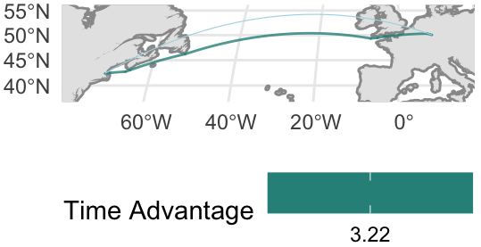
availability, runways in use etc.A route from himach looks something like this, shown in
green on the map. The great-circle route is shown in thin light blue,
for comparison. To avoid that the sonic boom reaches land, we have added
a buffer around the coast, shown in dark grey.
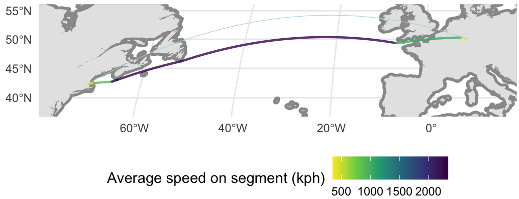
If we plot a speed view of the same thing, we see that the route maximises the distance over which supersonic speeds may be maintained.
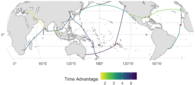
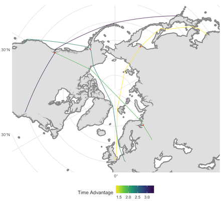
Compared to some of the larger subsonic passenger jets, the second generation supersonics are expected to have relatively short range. So finding efficient re-fuelling points is an essential part of the modelling process. This map shows some examples (the results depend on which airports you make available as possible re-fuelling points).
Other useful features of himach include:
The routes shown here are specific to the input data: it used a test
aircraft and open source geographic data. See the vignettes for a worked
example of how to get your own data into himach.
You need maps and airport data, both available from other R packages, as the vignette shows. This package provides a short list of aircraft for illustration purposes only, the aircraft data were taken from Wikipedia and most-likely out of date. Add your own aircraft performance data: the vignette shows how.