![]()
A collection of geospatial datasets and map plotting helpers for working with New South Wales maps. The maps are registered with {cartographer} and so are compatible with {ggautomap}.
You can install nswgeo like so:
# CRAN release
install.packages('nswgeo')

# development version
install.packages('nswgeo', repos = c('https://cidm-ph.r-universe.dev', 'https://cloud.r-project.org'))The data can be used directly with ggplot:
library(nswgeo)
library(ggplot2)

ggplot(nswgeo::lhd) + geom_sf(aes(fill = lhd_name), show.legend = FALSE)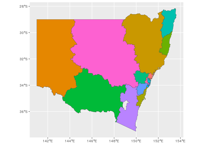
Alternatively, the data can be accessed through {cartographer}:
library(cartographer)
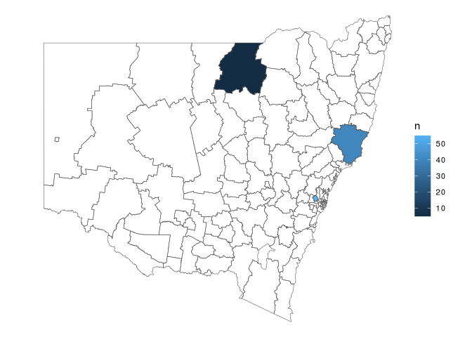
head(covid_cases_nsw)
#> # A tibble: 6 × 5
#> postcode lga lhd year type
#> <chr> <chr> <chr> <int> <chr>
#> 1 2427 Mid-Coast Hunter New England 2022 B
#> 2 2761 Blacktown Western Sydney 2021 A
#> 3 2426 Mid-Coast Hunter New England 2022 B
#> 4 2148 Blacktown Western Sydney 2022 B
#> 5 2768 Blacktown Western Sydney 2021 A
#> 6 2766 Blacktown Western Sydney 2021 B
covid_cases_nsw |>
dplyr::count(lga) |>
add_geometry(lga, feature_type = "nswgeo.lga") |>
ggplot() +
geom_sf(aes(fill = n)) +
geom_sf(fill = NA, data = map_sf("nswgeo.lga")) +
theme_void()